Helsinki Metro Map: Integration of Scales
September 2017
Helsinki has only one metro line but that single line is an integral part of the extensive public transport network covering the entire metropolitan area.
When I started mapping Helsinki as part of my One Metro World series I soon realized that if the map was to be useful it would have to show the entire rail based network.
Cityscape
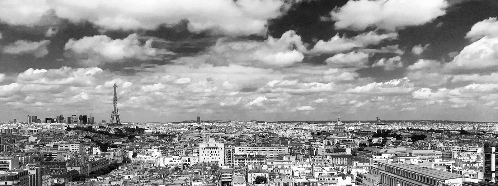
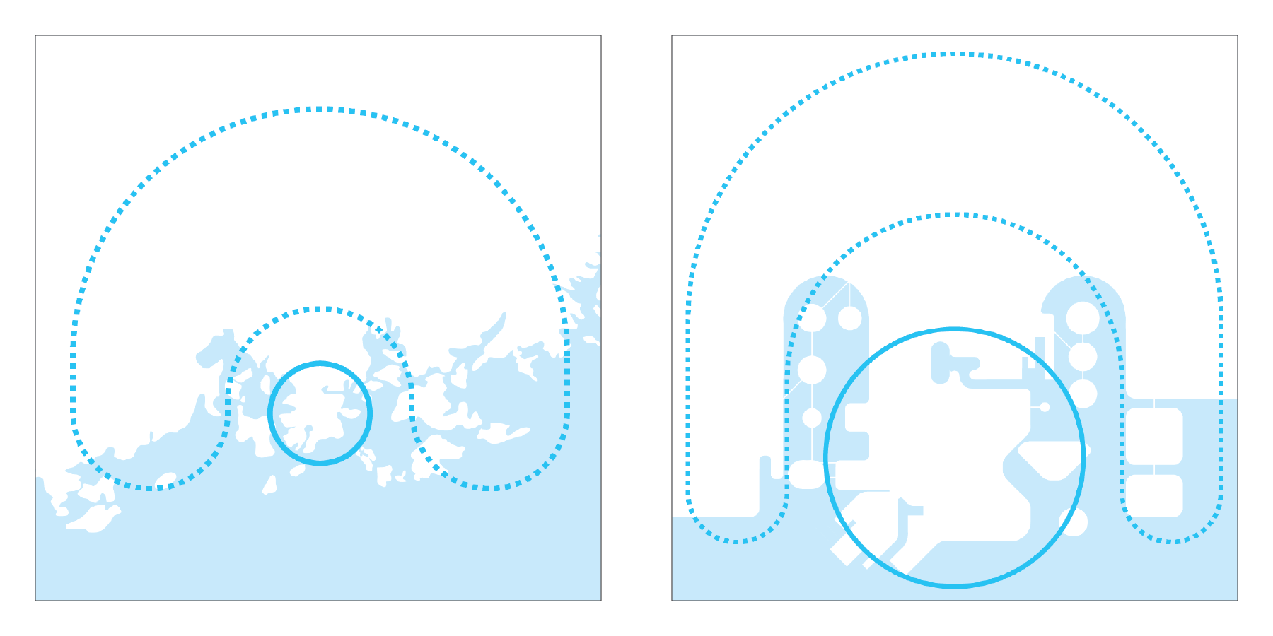
The historic center of Helsinki is located on a peninsula with two bays sprinkled with islands to the East and West and the vast expanses of the Gulf of Finland to the south. The area is densely built with closed building blocks enclosed in an orthogonal street grid. Beyond the bays and North of the peninsula, peripheral neighborhoods form an urban crescent interspersed with fields and woods.
Therefore two very different urban scales need to be accommodated on the map:
- The pedestrian scale in Downtown area where information is dense
- The transit scale in the peripheral crescent where information is sparse
In order to achieve information balance and readability the landscape is simplified and distorted:
- The peninsula is enhanced
- Periphery is contracted
- The coastline is simplified
- Islands are symbolically represented as plain circles
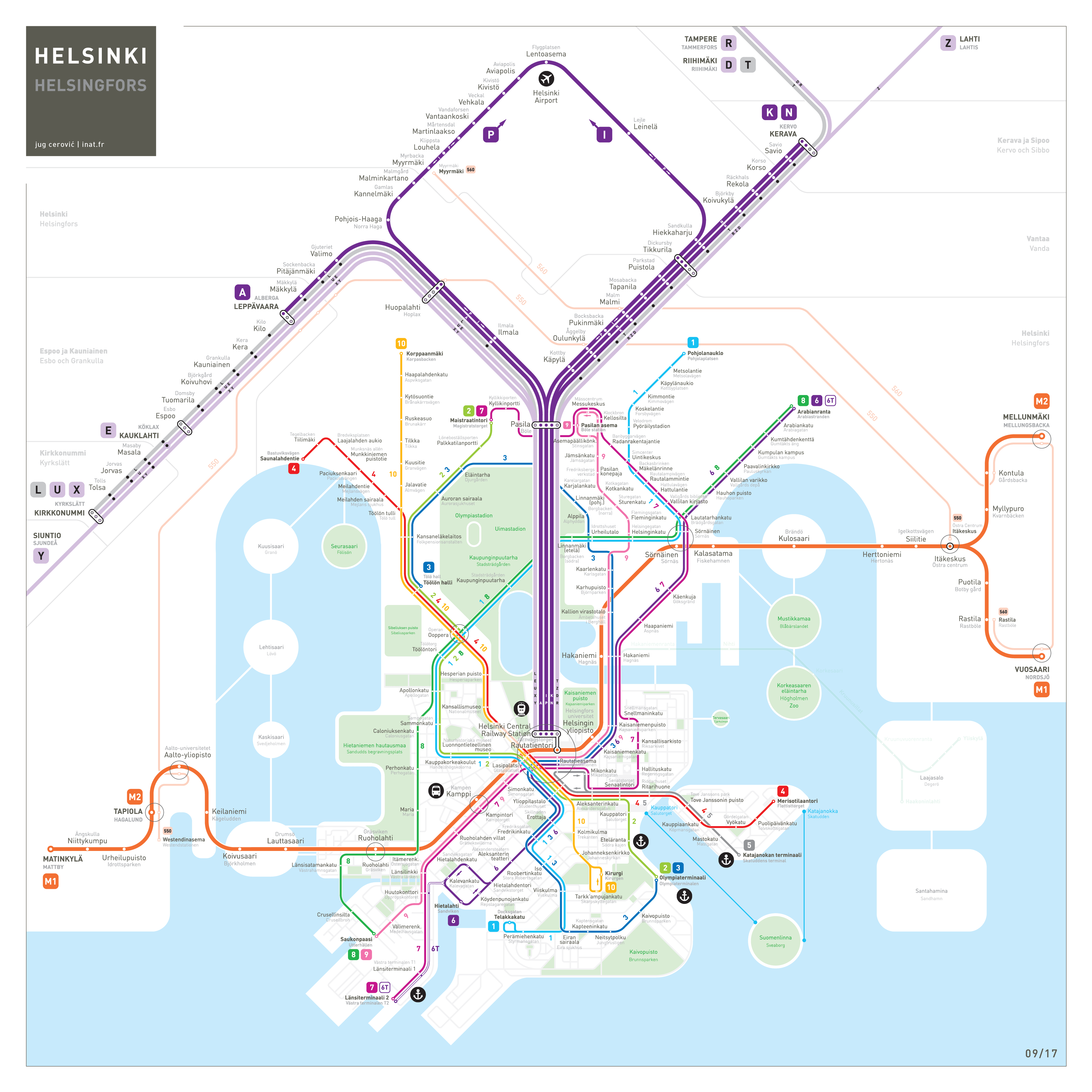
3 rail based transport networks serve the metropolitan area. Metro and suburban rail lines connect the center to the periphery while the tramway network covers the Downtown area and its immediate approaches to the north.
All 3 schematized networks fit nicely inside the previously adapted layout. Map space is allocated to each one of them in correlation to the amount of transit information (stations, labels and numbers) rather than geographic coverage.
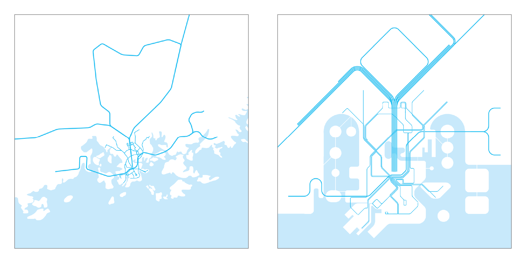
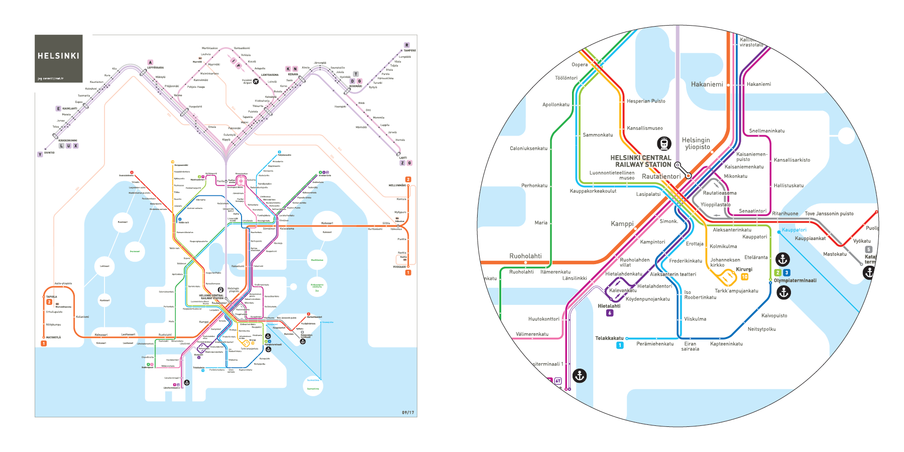
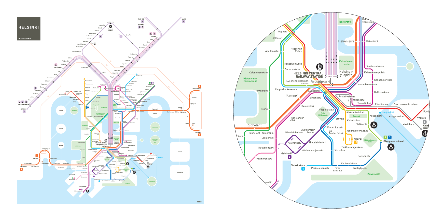
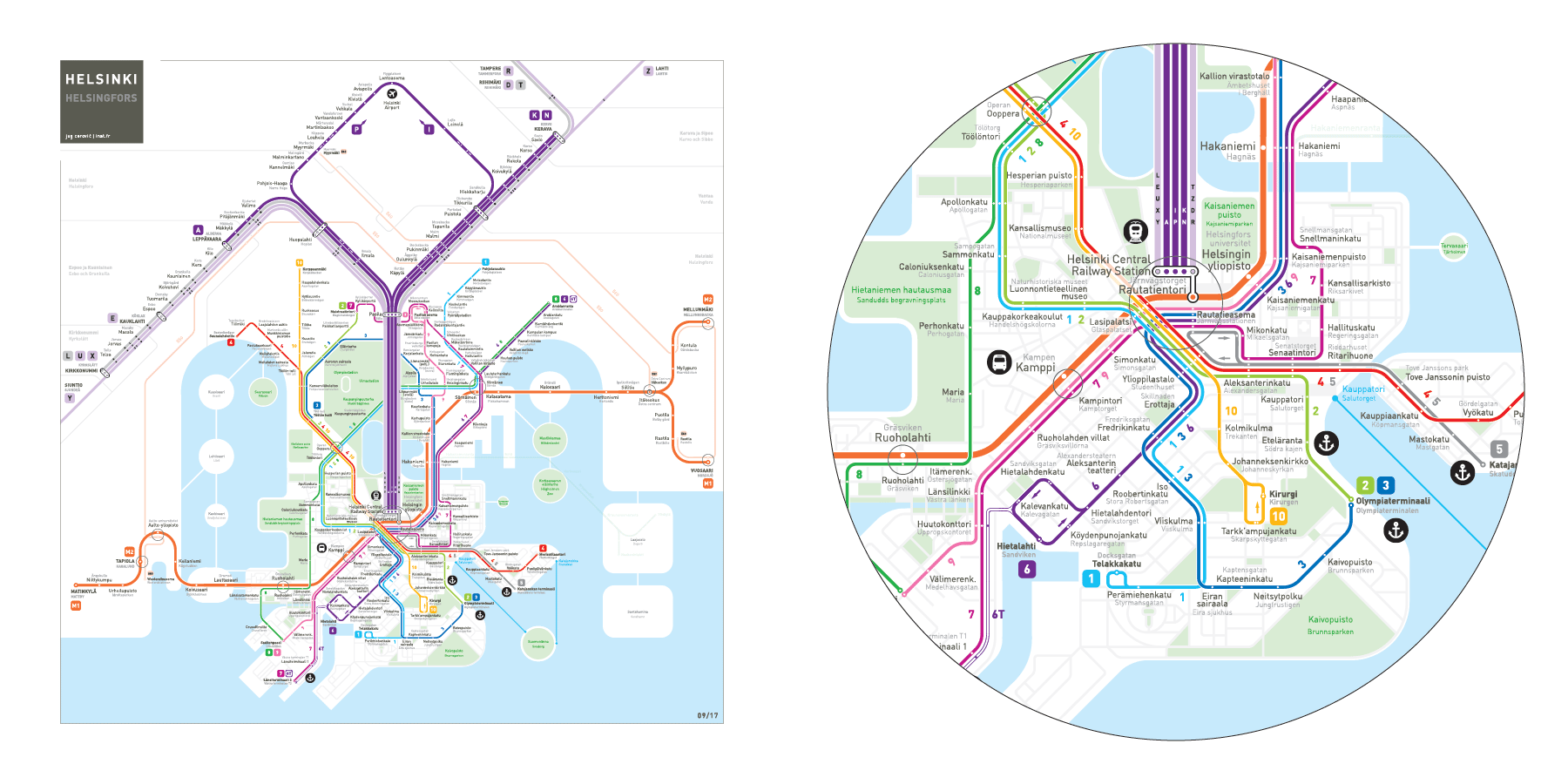
Network map: geographic and schematic
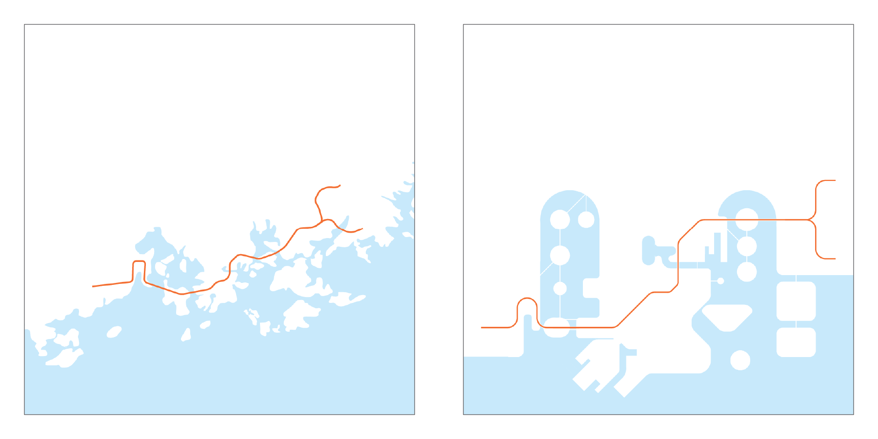
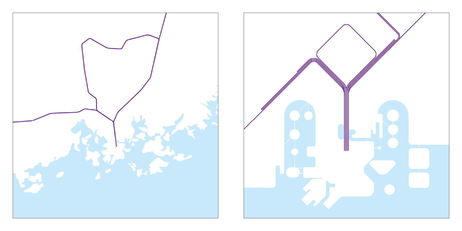
Metro: East-West connection
A single metro line with two branches connects Eastern and Western suburbs across the bays with the Downtown peninsula. It has a connection with the suburban rail at the Main Railway Station as well as several transfer points with the tramway network.
On the map the route is simplified but topological accuracy is maintained.
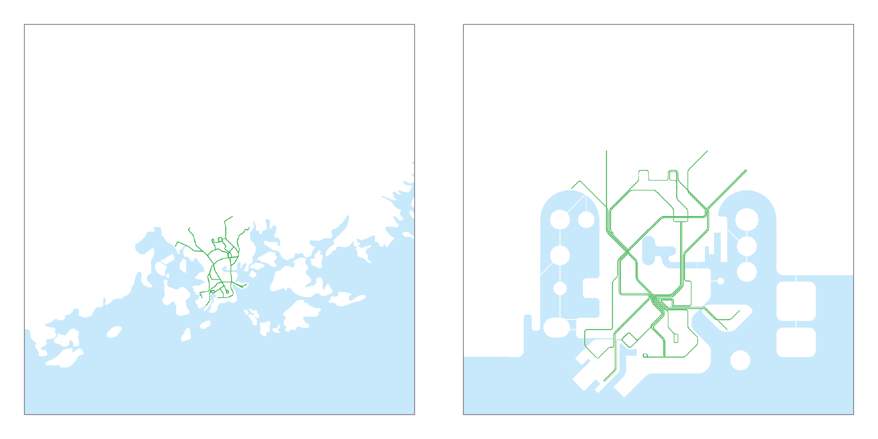
Suburban Rail: North-South connection
All suburban rail lines share a common trunk route from the Main Railway Station on the peninsula towards the north. Beyond Pasila they separate into 2 branches and one loop:
- Western branch to the West
- Airport loop to the North
- Eastern Branch to the North-East
On the map the loop is symbolically represented as a rounded angled diamond with the airport on top. The branches are straight lines emerging from the diamond.
Local, express and night trains are represented as separate offset lines in order to show without ambiguity which stops are served or not by skip-stop express trains.
No stop, no dot.
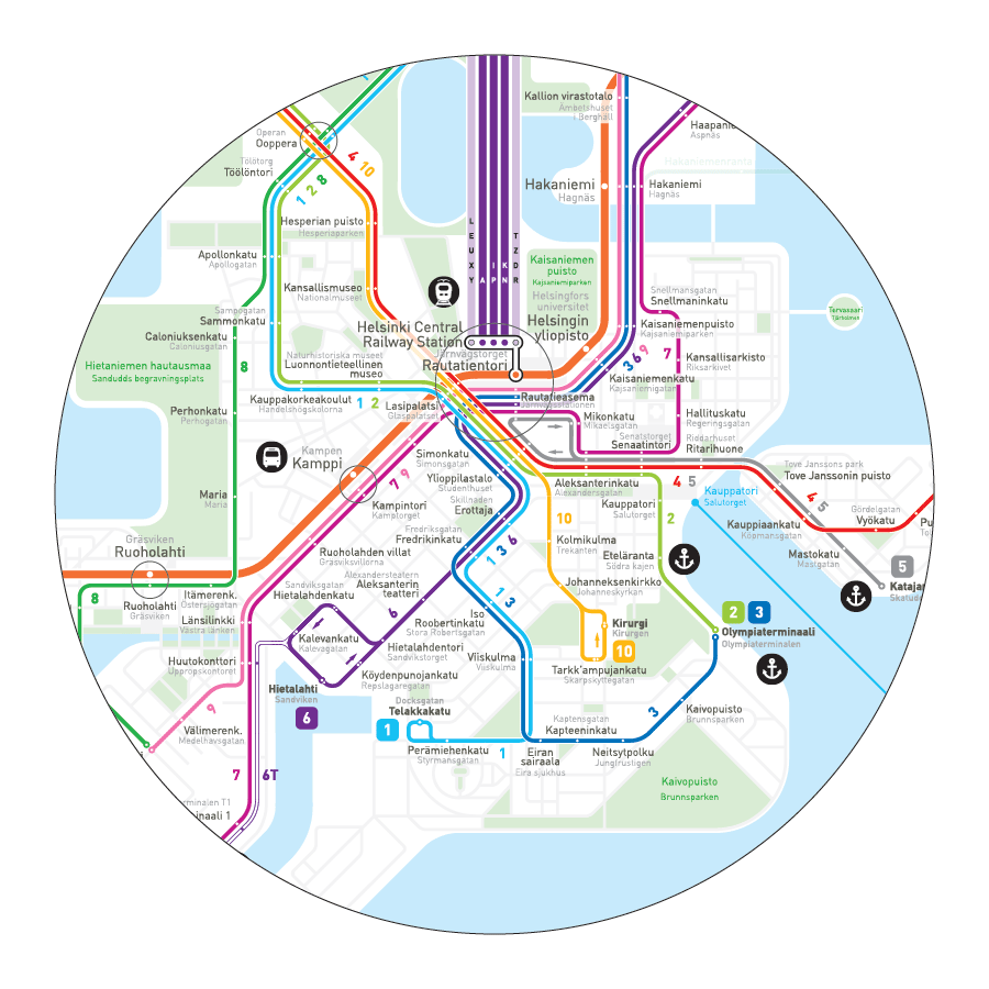
Tramway: Downtown connection
Downtown is the realm of trams. The tramway network is very different from metro and rail in so much as it functions on a smaller scale and speed, much more akin to the pedestrian rhythm. Tram lines closely follow the street pattern and stops are set only several minutes of walk apart. Often you are better walking across a neighborhood than transferring to another tram line to get to the other side.
The tramway part of the map therefore has to conform as much as possible to the real scale, the streets and the network’s tangible geography, else it would not correspond to the tangible reality that surrounds you and your mental image of the city. Luckily in Helsinki the orthogonal street pattern is set on a vertical axis or on an diagonal close to 45° which makes for a seamless transformation of geography into an octolinear schematic.
Each tramway service is portrayed as a separate line identified with a unique color and number.
Each station is shown as a dot on the line with bilingual labels pointing to it.
In order to clearly identify the part of the map that is shown up to scale and further enhance navigation and wayfinding I have added parks and all downtown street and squares.
The resulting map is at the same time a schematic diagram of transit services as well as a wayfinding tool for pedestrians in the downtown area.
Map improvement: Feedback from citizens
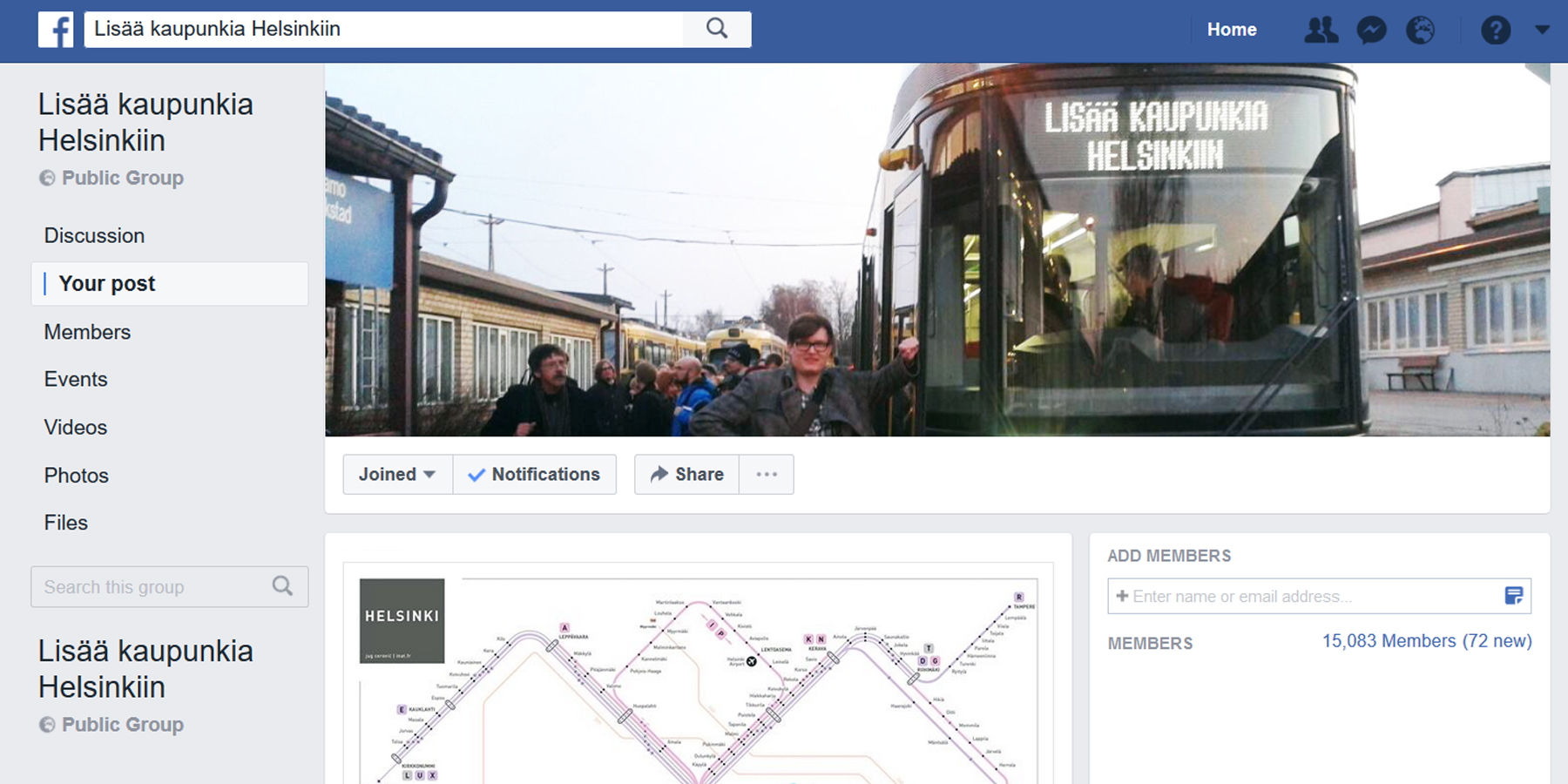
Lisää kaupunkia Helsinkiin facebook group page
When I first published this map on Skyscrapercity forum I was advised to also post it on the Lisää kaupunkia Helsinkiin facebook group page, a 15 000 members Helsinki YIMBY group. Great advice indeed, there I received a warm welcome, sincere congratulations and extensive feedback.
I am particularly thankful to Elmo Allén, an outstanding gentleman who generously shared with me the hard learned knowledge and experience from his own mapping of Helsinki.
Such an enthusiastic reception gave me the impetus to push the design further and with publish/feedback/redesign iteration the map kept improving:
Version 1.1
Feedback from the group:
- Bays should be contracted to make more room for the periphery East and West
- Jätkäsaari should not be shown as an island
- Laajasalo and Santahamina islands are missing
- The metro line should be topologically accurate, horizontal, on its extremities and on Kaivokatu (Downtown)
- Symmetric suburban rail lines, though aesthetically pleasing, are too far removed from real geography
- Suburban lines should not be shown in detail beyond the metropolitan limits
- The airport should be on top of the loop
Version 1.2
Improvements:
CITYSCAPE
- Reduced bay width to make room for neighborhoods East and West
- Added main parks
- Jätkäsaari is shown as a peninsula, not an island, and its perimeter is revamped
- Added Laajasalo and Santahamina in the East, placed Vuosaari closer to water
- Keilalahti is singled out as peninsula
METRO
- In the East both 2 branches are now horizontal and symmetric, closer to their real shape
- In the West the line is horizontal after the bend at Aalto-yliopisto
- In the center the line runs horizontally on Kaivokatu then parallel to Hämeentie
SUBURBAN RAIL
- The branches to Tampere and Lahti are cut off from the map, the last station shown is Kerava
- The Western branch is revamped to place Leppävaara closer to where it should be
- 5 separate lines go all the way from Pasila to the Main Station to clearly show the 5 available service groups
- The airport loop is enlarged and the airport is placed right on top of it
ORBITAL BUSES 550/560
- Routes are now connected with metro/rail stations where transfers are available with a bus stop placed right next to the corresponding station.
TRAMS
- All trams run horizontally on Kaivokatu
- Southern loop of line 10 is set on a North-South axis
- Added Saunalahdentie bend on line 4 northern end
- Line 7 set on a diagonal on Tyynenmerenkatu, parallel to line 9 on Välimerenkatu
- Lasipalatsi intersection revamped
- Lines 7 and 9 never intersect each other
Feedback from the group:
- Labels should be bilingual Suomi + Swedish
- Sompasaari area should be more detailed as it is ongoing development
- Tramway terminus numbers should be bigger
- Local suburban trains could be shown as metro lines
- Fare zones are missing
Version 1.3
Improvements:
GENERAL
- The map is now entirely bilingual
CITYSCAPE
- All Downtown streets and parks are shown
- Sompasaari area is more detailed
TRAMWAY
- Added line numbers along the way
- Terminus numbers are larger
- Added the future Kruunusillat line to Laajasalo over the Eastern bay (transparent turquoise)
SUBURBAN RAIL
- Lines that stop at every station are shown the same way as metro lines, in bright purple
- Added fare zones, they fill up the blank upper corners nicely
In the current stage of development the Helsinki Metro Map has become an intuitive and efficient tool for navigation as well a work of art mirroring the mental image of the city.
Compact, efficient, beautiful.
High resolution map at inat.fr/metro/helsinki
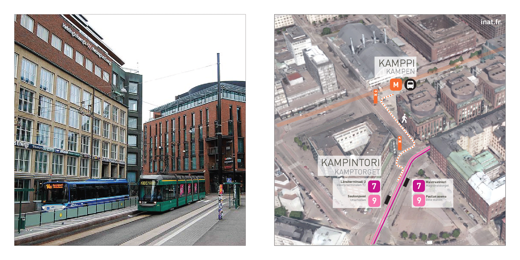
Future improvement: Buses, transfers and wayfinding
In a city wide wayfinding system the schematic map is only one of the many semiotic tools that contribute to seamless urban navigation. Nevertheless it is an essential one as it is ubiquitous, trusted and cherished by an entire urban population. Thus this map is an excellent basis for the development of a consistent set of wayfinding tools across all scales and networks of the metropolis.
In Helsinki this could include the integration of bus routes into the network map, a consistent signage system and easy and intuitive modal transfers. Such a city wide visual standard would comfort the dynamic image of the metropolis and become part and parcel of its identity.

Helsinki new city brand by Werklig
Helsinki Metro Map is developed by architect Jug Cerovic, a leading actor in the global community creating next generation transit maps. Explore all our works at www.inat.fr
In partnership with wayfinding and signage consultancy DezignTechnic we develop and implement tailor made solutions for navigation and wayfinding on a metropolitan scale.